Nepal Journal — Saturday, 11/30/96
Day 9: From Kalopani (2560m) to Tukuche (2590m)

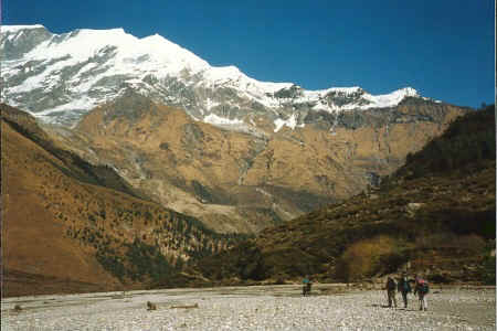
Thak Khola riverbed
Just north of Kalopani, the trail completely changes in character: instead of rising and falling as a narrow strip above the river, the trail drops down to the riverbed itself. Beyond this point, the Kali Gandaki river becomes known as the Thak Khola. The riverbed is very wide in some places, and quite rocky, so the trail isn't always clear. As predicted in the guidebook, the wide riverbed carries very strong winds. These blow gently from the north until around 11:00 a.m., then howl fiercely from the south during the afternoon. We're heading north, so we have the worst of the winds at our backs, but the wind still manages to make the region seem forlorn and desolate--almost lunar in character.
In the village of Khobang, we come across a gompa (a kind of temple) near a waterwheel. A priest--or priestess? It's hard to tell--encourages us inside. He/she performs a small service, banging on a drum, blowing a horn, and chanting.

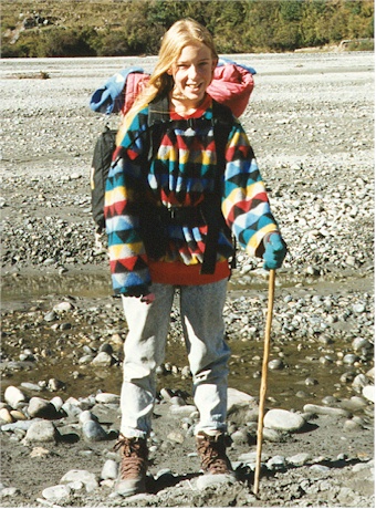
Skye (with her slightly-too-short walking stick)
Moving on, we come to village of Tukuche for lunch, then decide to call it a day and spend the night at a place called the Sunil Guest House. They have the unbelievable luxury of an electrically heated hot shower, which we all indulge in. (Chris, unfortunately, doesn't manage the shower controls, and ends up with only a lukewarm shower.) Afterward, we explore Tukuche a little bit, including a small brandy-making operation, but there's not much going on there.